Our Precious World
In the first week of our topic, the children have already looked at different ways the world is divided up by geographers and how a country's proximity to the equator affects its climate...
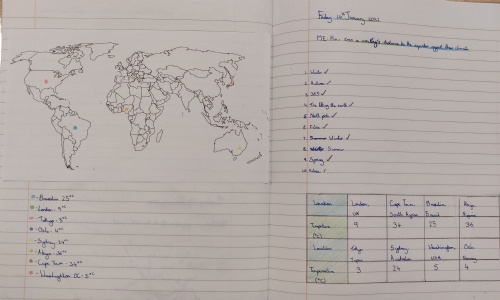
The children developed their map and atlas skills by locating a variety of cities from around the world and mapped their temperatures and placement onto a map. This clearly demonstrated that those countries near to the equator had a higher temperature, and temperatures drop as you move further away from this imaginary line around the centre of the earth.